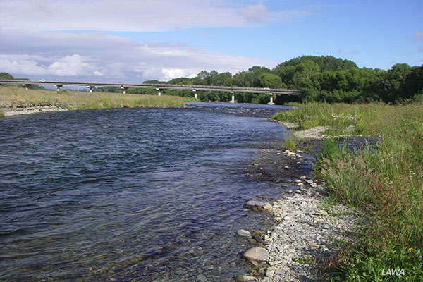
Opihi River
The Opihi River interactive catchment map is a hill-fed river with numerous tributary streams; Opuha, Kakahu, Waihi, Tengawai and Temuka, in a total catchment area of approximately 245,000 hectares. It flows some 75km through south Canterbury, in the South Island, before reaching the Pacific coast 10km north of Timaru.
The lower reaches of rivers and streams have moderate nutrient enrichment often with high bacterial concentrations. This is most likely a result of the subsequent effects of high land use pressures from such activities as pastoral beef and sheep, dairying and cropping, through which these waterways flow.
Strong nor’ west winds and low annual rainfall during summer months results in the catchment being prone to drought conditions.
Biodiversity & cultural significance
Extract from the Orari-Opihi Zone Implementation Programme (page 6-7):
‘Water is precious and limited. It must be managed in ways that recognise and balance its importance for cultural, economic and recreational use, aesthetic and landscape values and biodiversity values – and delivers both individual and community good. We affirm and recognise tangata whenua and the value they place on mahinga kai, and the priority of available high quality sources of drinking water in rivers, waterways and aquifers.
We also recognise the intrinsic value of aquatic ecosystems and river health (quality and flow), and the need to both prevent further decline and then restore wetlands and waterways.
We know that to achieve all the targets of the CWMS within our zone it is necessary to strategically manage the water within our zone and provide opportunities to bring more water into the zone.’
Important Bird Areas on Opihi River: links to 6-page PDF file that includes maps, habitat types, and threats relevant to this river. This document was extracted from Forest & Bird’s 177-page 20Mb file on all rivers, lakes, and coastal areas.
Bird surveys
- See Canterbury Maps braided river bird database for surveys | see here for a user guide
- 2023 bird survey (PDF)
- 2019-2023 Summary data collection
- 2019-2023 river bird survey lower river (xls raw data)
- 2019-2023 river bird survey upper river (xls raw data)
- 2011 – 2019 (xls raw data)
- 2014 river bird survey (xls raw data)
- 2011, 2013, 2014 Survey Report
Water flow
- River Report 24-hour Infoline: river flows (updated twice daily), rainfall, sign up for text alerts
- Interactive catchment map and monitored sites: include scientific indicators for water quality.
References & research material
- Hearnshaw et al (undated): Ecosystem Services Review of Water Storage Projects in Canterbury: The Opihi River Case
- ECan document library: enter Kowai River in the keywords search field (you will also come across information on other rivers of the same name, so look for names like Amberley or Leithfield in the titles)
- DOC catalogue of scientific publications: enter the relevant search terms in the ‘search’ dialogue box. You may need to vary your search, for example ‘black stilt’ gives far more results than ‘kaki’ or ‘kakī’
- See Rivers for a more comprehensive list of braided rivers research and reference material